

Colorado is bracing for a weekend of extreme meteorological whiplash as the Front Range shifts from record-threatening heat and critical fire conditions to a full-blown winter storm in less than 24 hours.
Residents in Denver and surrounding areas have been urged to stay weather-aware as the state transitions from “fire to ice.”
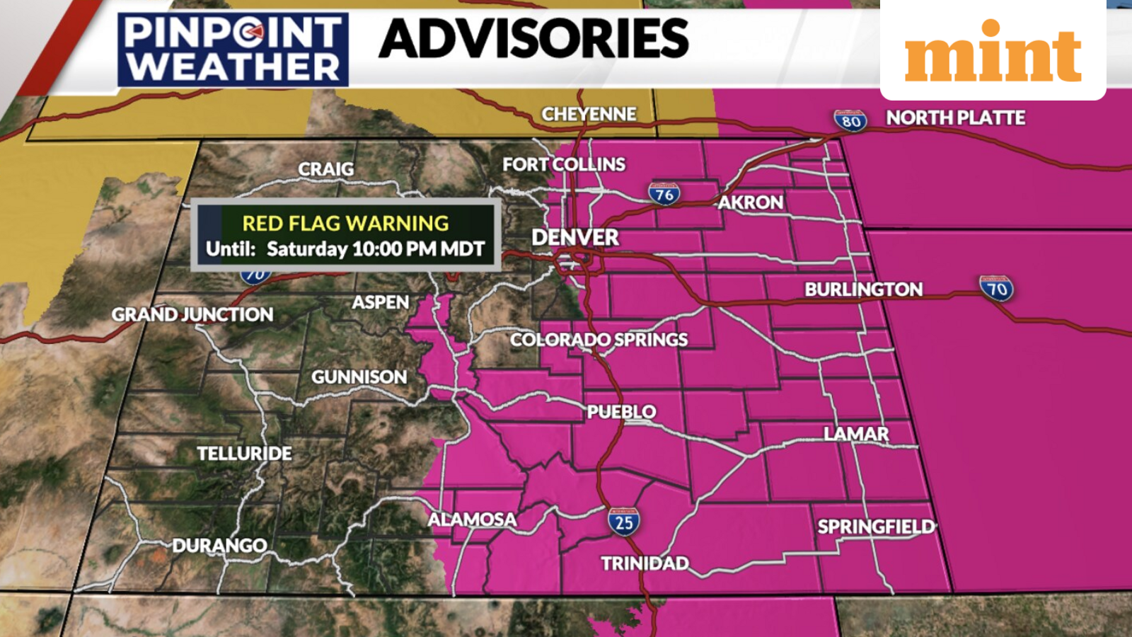
Colorado is no stranger to “four seasons in a weekend,” but the swing from a Red Flag Warning on Saturday to a Winter Storm Warning on Sunday is a stark reminder of the region’s unpredictable climate.
Saturday: Critical fire danger and high winds
Residents of Denver and much of the plains will begin their Saturday with a Red Flag Warning issued by the National Weather Service (NWS) from 11 am to 10 pm.
Unseasonably warm temperatures, gusting winds, and bone-dry humidity levels are likely to create a “powder keg” environment.
According to the forecast, winds are expected to gust between 35 and 50 mph, making any spark nearly impossible to contain.
Local fire departments have pre-positioned resources and have issued a strict ban on outdoor burning across most of the Front Range.
Residents have been advised to avoid any activities that could cause a spark, including using power tools outdoors or discarding cigarettes improperly.
The high temperature in Denver is expected to hover near record levels for mid-March, providing a deceptive start to what will eventually become a very cold weekend.
The transition: Saturday night’s cold front
The weather will take a dramatic turn late on Saturday night as a powerful cold front is expected to slam into the Rockies. Temperatures are expected to plummet by as much as 40 degrees Fahrenheit in a matter of hours.
By midnight, the parched air will give way to increasing moisture, turning the high-wind event into a precipitation event.
Sunday: Winter storm warning and snow
By Sunday morning, the Colorado landscape will likely look entirely different as a winter storm warning is in effect for the Denver metro area, Boulder, and the Foothills.
Forecasters have predicted significant snow accumulations, with the heaviest bands expected between 6:00 AM and 4:00 PM on Sunday.
According to the current prediction, current models suggest that the Denver Metro area will receive 5 to 9 inches of heavy and wet snow, while the Boulder and Golden area is bracing for 8 to 12 inches of snow.
The Colorado foothills and mountains are expected to get 12 to 18+ inches of snow on Sunday.
The snow is expected to be “cement-like”—heavy and moisture-rich—posing a risk to power lines and tree branches that may already be stressed from Saturday’s high winds.
Travel advisory
Travel on Sunday will be hazardous. The Colorado Department of Transportation (CDOT) is warning drivers to stay off the roads if possible, particularly along the I-25 and I-70 corridors.
Rapidly cooling road surfaces will cause the initial rain-to-snow transition to freeze quickly, creating a layer of “black ice” beneath the accumulating snow.
Visibility will also be a major concern, with blowing snow reducing sightlines to near zero at times during the peak of the storm on Sunday afternoon.