

Areas under heavy snow: Hudson Valley, Southern CT, Long Island
According to NWS New York, the Lower Hudson Valley, southern Connecticut and Long Island are seeing the heaviest impacts.
Expected snowfall: 6 to 11 inches, locally up to 12 inches
Highest totals: Interior southern Connecticut
Lowest totals: Southwestern Long Island, where sleet mixed in at times
Peak snowfall rates: 1–2 inches per hour, briefly up to 3 inches per hour in southern Connecticut
Temperatures in the lower to mid-20s supported dry, powdery snow, while slightly warmer air over southwestern Long Island produced wetter snow.
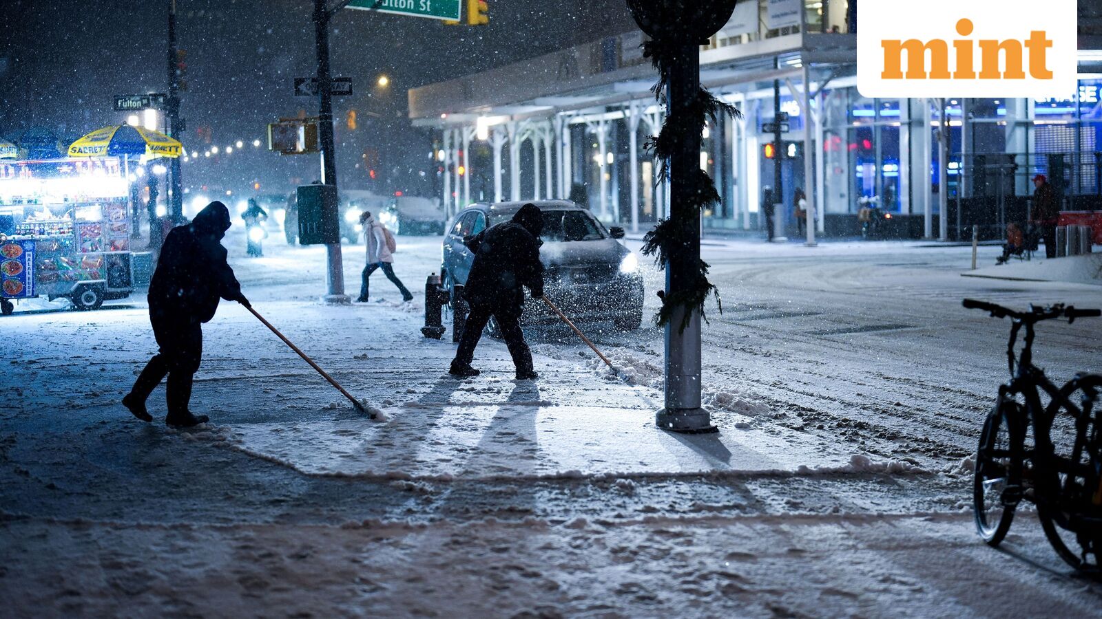
Wintry mix impacts NYC and Northeast New Jersey
Much of northeast New Jersey and the New York City metro experienced a wintry mix, NWS New York said.
Snow and sleet totals: 2 to 5 inches, locally up to 6 inches
Freezing rain: Light glaze of ice possible
Changeover: Wintry mix transitioned to all snow after 10 pm
Snow type: Wet snow with temperatures in the upper 20s to low 30s.
The mix of snow, sleet and ice increased the risk of slick roads, isolated downed tree branches and potential power outages.
Travel conditions and visibility warnings
NWS New York warned of difficult travel conditions overnight due to intense snowfall rates, snow- and ice-covered roads, and sharply reduced visibility. Visibility dropped to as low as a quarter mile at times, particularly before 1 am as heavier snow bands moved through the region.
What forecasters are watching
Forecasters at NWS New York said key uncertainties include how long intense snow bands persist and the timing of the transition from a wintry mix to all snow across New York City and northeast New Jersey. A Winter Storm Warning remains in effect for the local Tri-State area until 1 pm Saturday.
National weather outlook: Arctic blast, Midwest blizzard risk
Looking ahead, the Weather Prediction Center said Arctic air will plunge into the Plains beginning Sunday, followed by a powerful winter storm across the upper Midwest and Great Lakes Sunday night into Monday.
Blizzard conditions are possible, with snowfall expected to exceed a foot in parts of the region, especially along the south shore of Lake Superior.

